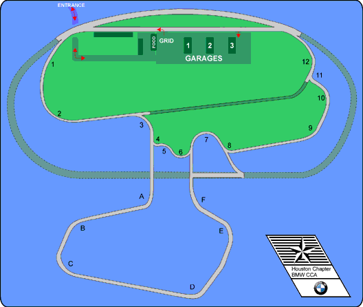
TWS Online Course Map |
Here is a mostly accurate map of the 1.8, 2.8 and 2.9 mile road courses at Texas World Speedway. The portion of the oval that is not used for the road courses is shaded in dark grey while the section of track that is only used for the 3.1 mile configuration (between turns 3 and 11) is shaded in dark green. While not in use, the latter is accessible as a service road from the garage area.
![]() The Lone Star Region of the Porsche Club
of America has written a short introductory document describing
the driving line around TWS for use in their High Speed Driver's
Ed. courses. See our online copy of the
document.
The Lone Star Region of the Porsche Club
of America has written a short introductory document describing
the driving line around TWS for use in their High Speed Driver's
Ed. courses. See our online copy of the
document.
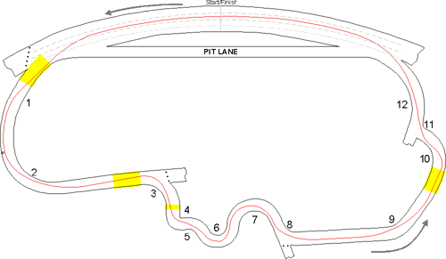
Less dimensionally accurate but interesting from a driver's point of view, here is a map of a typical line around the 1.8 mile course in a front-engined, rear-wheel-drive car such as a BMW. The yellow shaded areas on the map represent typical braking zones:
Also, here is another map from a later Driver's Ed. event with the line around the 2.9 mile configuration:
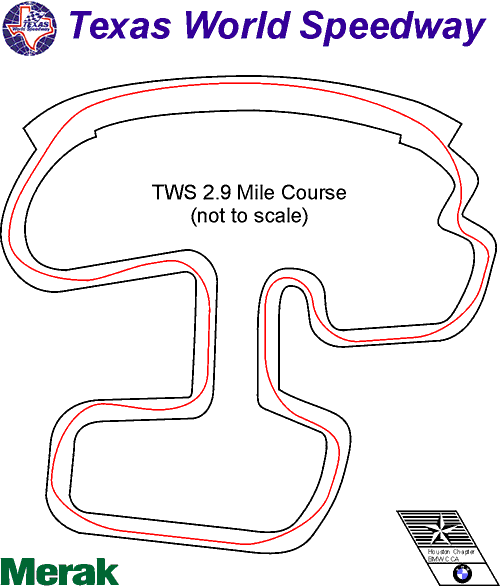
Of course, these maps do not represent the one and only line around the course, but is meant to be an illustration of the typical line taken by drivers of BMWs and similar cars. "Your mileage may vary" as the saying goes...
For comments on these maps, please email Carl W. Irving (cwirving@ix.netcom.com).